Total Distance: 8.8 mi
Total Time: 4:12:06
Moving Time: 2:36:06
Average Moving Speed: 3.4 mi/h
Max Speed: 5.0 mi/h
Another late post! And another loop, due to great laziness! We did this paddle on September 27th. Rather than doing Bethel Park to Vann's Tavern, we looped from Bethel.
View Lake Lanier Shoreline Segments in a larger map
Projected Route
View Kayaking in a larger map
Actual Route
As you can see, we also swung a bit out of the way to investigate some islands and look for geocaches. The GPS dropped a bit of the route at the end, but I assure you we made it a full loop, rather than magically teleporting from the islands back to the car.
The day was beautiful, and Bethel Park was another nice, quiet put in. No parking fee, good restroom and drinkable water. JD also claims to have run into a friendly kitty while I was loading the car.
This loop didn't have quite as many cool features as Little River, and the boat traffic was much heavier. One nice thing is that the route could be as long as you wanted it to be - a plethora of inlets meant we probably could have added another 2-3 miles if we had followed each one.
The islands were very cool and much larger than we had expected from the map. There are 5 or more geocaches on the islands - we'll definitely be going back when we're not quite so tired. This may also be a good spot for a rustic over-night.
Fun time, happy paddlers!
Friday, November 13, 2009
Segment 33 - Little River Loop
Total Distance: 8.0 mi
Total Time: 3:06:27
Moving Time: 2:26:15
Average Speed: 2.6 mi/h
Average Moving Speed: 3.3 mi/h
A late post! Finally! We actually did this segment back on August 29th and started a review but never finished because we were slackers about unloading pictures. So without further ado - the Little River Loop!
We've been picking and choosing routes that we can easily turn into loops, largely because I (Lisa) am a lazy slacker about driving and don't feel like shuttling the cars. The Little River segment was a great candidate for looping, since it follows a little inlet waaaaay back.
View Lake Lanier Shoreline Segments in a larger map
Projected Route
View Kayaking in a larger map
Actual Route
Little River is small but nice park with no parking fee and a well-kept restroom. There's a little space for picnicking and a floating doc for fishing. Quite nice!
JD Getting Ready and the Ramp
Fishing Dock
The day started out absolutely beautifully - balmy and warm and sunny. The paddle itself had a lot of cool features - and did I mention that this was the first trip with our new waterproof camera? Below are some of the cool sights we saw.
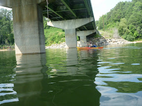
Lisa Finds a Bridge
And a large tree. In the middle of the lake.
The very tip of the loop meets up with a small stream - we probably could have paddled another few miles up it. It was a wonderful, tranquil place to paddle, with smooth, green water and nary a speed boat in sight. Also some weird algae, but we'll overlook that.
The clouds came rolling in at the end of the day, which made for some spectacular skies... and then a fast dash as we tried to make it back to the car before the heavens opened up. We got drizzled on a bit, but made it off the water before it could pour.
All in all, a gorgeous, quiet section of the lake, and one I would be happy to paddle again sometime.
Saturday, August 15, 2009
Segment 3: Lanier Beach to Mary Alice Park
Estimated Length: 4.1 miles
Actual Length: 4.0 miles
Time Taken: 71 minutes (moving)
Average Speed: ~3.5 mph
Date: August 15th 2009
Casualties: A few minor blisters and an ant bite.
(All data gleaned from the GPS except the estimated length)
This is the estimated path of Segment 3
And this is the actual route. As you can see we decided to make a loop out of this segment rather than ferrying the boats. The final cut across open water is not included in the statistics above (it brings the total to 4.71 miles).
Lake Lanier Beach
This was a very nice put in, that I will happily use again for future kayaking. It has quite a bit of parking space, well maintained ramps and whatnot, and best of all: free access. The only downside is that there are no bathroom facilities there.
The Lake
This section of the lake is dominated by private boat docks that line the vast majority of the shoreline. There are generally very nice houses behind the docks, usually screened by large pine growth. The boat traffic was moderate... there were a lot of generally considerate boaters out but not so many that it seemed crowded. This segment goes past the Habersham Marina. This was a smallish operation, and was no problem at all to pass by. For future reference: it did not appear that you could launch a kayak from here.
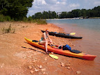
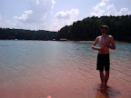
Since it was an absolutely gorgeous day out we stopped several times along the route on public and/or undeveloped land to go swimming. One of those stops was for lunch, on a red clay beach littered with large quartz rocks. We snapped a couple of pictures while were there:
From Kayaking |
From Kayaking |
From Kayaking |
Mary Alice Park
This was a pretty sizable area for parking and boat launching. The parking fee is $4, and it doesn't appear that a Georgia Park Pass will fly. It looks like there is a very nice beach just north of the boat ramps... I guess we'll see when we do Segment 4, eh?
Wednesday, July 29, 2009
Inception
So rather on a whim, Pyrona and I decided that a fun project to keep us occupied and active for a while would be to kayak around the entire shoreline of Lake Lanier, just north of Atlanta. In sections, because we haven't got the several weeks it'd take to do it straight. How far could it possibly be, right? Well, we checked and according to wikipedia, the shoreline extends for 692 miles. Goodness.
So! Feasibility first! We checked online and found that the Corps of Engineers kindly provides a GPX file of all of the public boat ramps on Lanier. I imported this into GoogleMaps, added the marinas and campsites, and started plotting route segments along the shore, from landing to landing. 50 segments and roughly 300 miles later, we've got the route planned out. Between skipping the many islands and tracing a circle slightly smaller than the actual shore, we've managed to trim off 392 miles already! Damn I'm good!
Now to start the hard part... I'll be very curious to see how long this takes us (I'm hoping to finish 1 calendar year after I start... though this seems mathematically unlikely) and how close those nice straight lines I drew on a map correspond to the actual route as recorded with the GPS.
Here is a map of the landings:
View Lake Lanier Shoreline Paddle Map in a larger map
And here is a map of the 50 segments:
View Lake Lanier Shoreline Segments in a larger map
Subscribe to:
Posts (Atom)