Estimated Length: 4.1 miles
Actual Length: 4.0 miles
Time Taken: 71 minutes (moving)
Average Speed: ~3.5 mph
Date: August 15th 2009
Casualties: A few minor blisters and an ant bite.
(All data gleaned from the GPS except the estimated length)
This is the estimated path of Segment 3
And this is the actual route. As you can see we decided to make a loop out of this segment rather than ferrying the boats. The final cut across open water is not included in the statistics above (it brings the total to 4.71 miles).
Lake Lanier Beach
This was a very nice put in, that I will happily use again for future kayaking. It has quite a bit of parking space, well maintained ramps and whatnot, and best of all: free access. The only downside is that there are no bathroom facilities there.
The Lake
This section of the lake is dominated by private boat docks that line the vast majority of the shoreline. There are generally very nice houses behind the docks, usually screened by large pine growth. The boat traffic was moderate... there were a lot of generally considerate boaters out but not so many that it seemed crowded. This segment goes past the Habersham Marina. This was a smallish operation, and was no problem at all to pass by. For future reference: it did not appear that you could launch a kayak from here.
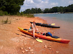
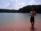
Since it was an absolutely gorgeous day out we stopped several times along the route on public and/or undeveloped land to go swimming. One of those stops was for lunch, on a red clay beach littered with large quartz rocks. We snapped a couple of pictures while were there:
 |
| From Kayaking |
 |
| From Kayaking |
 |
| From Kayaking |
Mary Alice Park
This was a pretty sizable area for parking and boat launching. The parking fee is $4, and it doesn't appear that a Georgia Park Pass will fly. It looks like there is a very nice beach just north of the boat ramps... I guess we'll see when we do Segment 4, eh?
No comments:
Post a Comment